3D atlas of China published
chinaplus.cri.cn |
Updated: 2018-08-17 10:33


Share


Share - WeChat


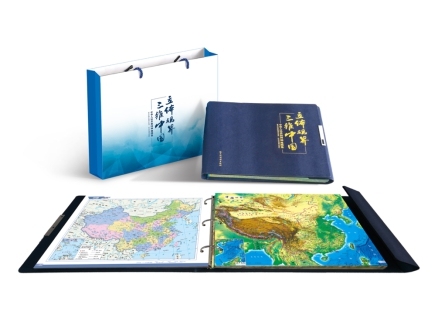
The first 3D atlas of China has been published by Harbin Cartographic Publishing House, the Science and Technology Daily reported on Wednesday.
The publisher has used a unique optical grating material to print some of the map images. The result is that the maps have a 3D appearance when looked at with the naked eye. The atlas provides data on transportation systems, tourists sites, and historical areas around China.


- Dog weddings — how new industry laps up puppy love
- Efficient medical care draws foreigners
- Arrival of Losar brings joy, good fortune to Tibetans
- Wide view seen as key to full grasp of China
- 10 dead and 84 injured in explosion at steel plant
- China unveils flexible urban planning rules to improve lives, foster new industries